 In the favelas, or slums, of Rio de Janeiro, Brazil, unnamed streets meander through the hillsides. There are hospitals, coffee shops and restaurants, none of which appear on a map, and mail carriers struggle to get letters to homes without addresses.
A new project by Rede Jovem, a Brazilian nonprofit that loosely translates to "Youth Net," seeks to change that. With the help of five young "wiki-reporters" and GPS-equipped mobile phones, the nonprofit is building a map of five Brazilian favelas: Complexo do Alemão, Cidade de Deus, Morro do Pavão-Pavãozinho, Morro Santa Marta and Complexo da Maré. By uploading information to the phones, the reporters are mapping the unmapped, one road and cafe at a time.
"The main goal was to mark public interest spots on a map and show places like schools and institutions and hospitals and restaurants," said Natalia Santos, the executive coordinator for Rede Jovem. "We wanted to spread the news about what slums do have, so all the people can get to know that the slum is not just a place for violence and marginality and robbery."
All the reporters are women, said Santos. Although they originally intended to have young men participate as well, the men were nervous about being in a the favelas with costly mobile phones. "The boys in the last phase of the selection said they wouldn't have the guts to walk with a cell phone in a slum," said Santos. "Girls can walk with a lot more freedom than boys, and boys get approached by the police." The young reporters are between the ages of 17 and 25, and all are in their final year of high school. The reporter who maps the most information will receive a scholarship to study communications or journalism at a private university.
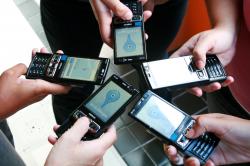
The reporters use Nokia N95s, which come equipped with GPS, and a mobile application developed by Rede Jovem that uses Google maps. When standing on a street, the reporters enter information on a map, labeling it as a corner, street or bystreet, said Santos. The reporters can then add photos or video directly from their phones, and label places like restaurants and hospitals. There is both a website, www.wikimapa.org.br, and a mobile site. Content added to the map is also automatically fed to a Twitter feed.
Funding for the project comes from a 150,000 Brazilian reais, or $87,310 U.S., grant from Institutional Oi Futuro, which is affiliated with Oi, the largest telephone operator in Brazil. The project will end in December, when the funding runs out, although Rede Jovem is currently applying for other grants, Santos said. In the future, the organization hopes to build a mobile application that works on other operating systems. Currently, the mobile application (available for download here) works only on Symbian phones. "We want everyone who has a cell phone with GPS to be a wikireporter," said Santos.
As the maps expand, they will be both utilitarian, and, on a larger scale, give legitimacy to the favela residents. "I think they are very happy because they're seeing that they exist," said Santos. "And the mailman says that now he can deliver the mail."
Photos courtesy of Rede Jovem.
Rede Jovem: Wikimapa Locations
In the favelas, or slums, of Rio de Janeiro, Brazil, unnamed streets meander through the hillsides. There are hospitals, coffee shops and restaurants, none of which appear on a map, and mail carriers struggle to get letters to homes without addresses.
A new project by Rede Jovem, a Brazilian nonprofit that loosely translates to "Youth Net," seeks to change that. With the help of five young "wiki-reporters" and GPS-equipped mobile phones, the nonprofit is building a map of five Brazilian favelas: Complexo do Alemão, Cidade de Deus, Morro do Pavão-Pavãozinho, Morro Santa Marta and Complexo da Maré. By uploading information to the phones, the reporters are mapping the unmapped, one road and cafe at a time.
"The main goal was to mark public interest spots on a map and show places like schools and institutions and hospitals and restaurants," said Natalia Santos, the executive coordinator for Rede Jovem. "We wanted to spread the news about what slums do have, so all the people can get to know that the slum is not just a place for violence and marginality and robbery."
All the reporters are women, said Santos. Although they originally intended to have young men participate as well, the men were nervous about being in a the favelas with costly mobile phones. "The boys in the last phase of the selection said they wouldn't have the guts to walk with a cell phone in a slum," said Santos. "Girls can walk with a lot more freedom than boys, and boys get approached by the police." The young reporters are between the ages of 17 and 25, and all are in their final year of high school. The reporter who maps the most information will receive a scholarship to study communications or journalism at a private university.
The reporters use Nokia N95s, which come equipped with GPS, and a mobile application developed by Rede Jovem that uses Google maps. When standing on a street, the reporters enter information on a map, labeling it as a corner, street or bystreet, said Santos. The reporters can then add photos or video directly from their phones, and label places like restaurants and hospitals. There is both a website, www.wikimapa.org.br, and a mobile site. Content added to the map is also automatically fed to a Twitter feed.
Funding for the project comes from a 150,000 Brazilian reais, or $87,310 U.S., grant from Institutional Oi Futuro, which is affiliated with Oi, the largest telephone operator in Brazil. The project will end in December, when the funding runs out, although Rede Jovem is currently applying for other grants, Santos said. In the future, the organization hopes to build a mobile application that works on other operating systems. Currently, the mobile application (available for download here) works only on Symbian phones. "We want everyone who has a cell phone with GPS to be a wikireporter," said Santos.
As the maps expand, they will be both utilitarian, and, on a larger scale, give legitimacy to the favela residents. "I think they are very happy because they're seeing that they exist," said Santos. "And the mailman says that now he can deliver the mail."
Photos courtesy of Rede Jovem.

Post new comment